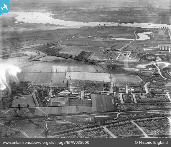
EPW035600 ENGLAND (1931). Dagenham Old Park and environs, Dagenham, 1931
© Copyright OpenStreetMap contributors and licensed by the OpenStreetMap Foundation. 2026. Cartography is licensed as CC BY-SA.
Nearby Images (5)
Details
| Title | [EPW035600] Dagenham Old Park and environs, Dagenham, 1931 |
| Reference | EPW035600 |
| Date | June-1931 |
| Link | |
| Place name | DAGENHAM |
| Parish | |
| District | |
| Country | ENGLAND |
| Easting / Northing | 549756, 184120 |
| Longitude / Latitude | 0.15947710279454, 51.535612842088 |
| National Grid Reference | TQ498841 |
Pins
Be the first to add a comment to this image!


![[EPW035600] Dagenham Old Park and environs, Dagenham, 1931](http://britainfromabove.org.uk/sites/all/libraries/aerofilms-images/public/100x100/EPW/035/EPW035600.jpg)
![[EPW035601] Dagenham Old Park and environs, Dagenham, from the north-west, 1931](http://britainfromabove.org.uk/sites/all/libraries/aerofilms-images/public/100x100/EPW/035/EPW035601.jpg)
![[EPW035603] Dagenham Old Park and environs, Dagenham, from the north-west, 1931](http://britainfromabove.org.uk/sites/all/libraries/aerofilms-images/public/100x100/EPW/035/EPW035603.jpg)
![[EPW035588] The Dagenham Breach and the Ford Car Manufactory Works in the distance, Dagenham, from the north, 1931](http://britainfromabove.org.uk/sites/all/libraries/aerofilms-images/public/100x100/EPW/035/EPW035588.jpg)
![[EPW035599] Dagenham Old Park and environs, Dagenham, from the north, 1931](http://britainfromabove.org.uk/sites/all/libraries/aerofilms-images/public/100x100/EPW/035/EPW035599.jpg)