
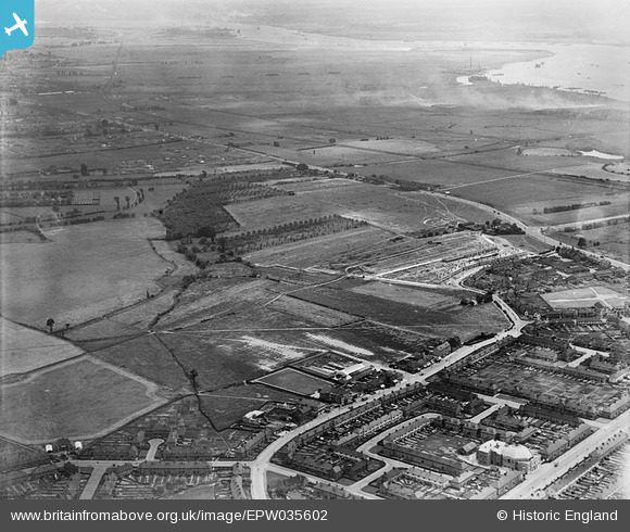
EPW035602 ENGLAND (1931). Broad Street, Dagenham Old Park and environs, Dagenham, from the north-west, 1931
© Copyright OpenStreetMap contributors and licensed by the OpenStreetMap Foundation. 2026. Cartography is licensed as CC BY-SA.
Nearby Images (5)
EPW035602

EPW035603

EPW010921

EPW035601

EPW035599

Details
| Title | [EPW035602] Broad Street, Dagenham Old Park and environs, Dagenham, from the north-west, 1931 |
| Reference | EPW035602 |
| Date | June-1931 |
| Link | |
| Place name | DAGENHAM |
| Parish | |
| District | |
| Country | ENGLAND |
| Easting / Northing | 549385, 184080 |
| Longitude / Latitude | 0.15411439220218, 51.535351708304 |
| National Grid Reference | TQ494841 |
Pins

mardell8 |
Monday 28th of October 2013 07:06:35 PM | |
|
Chelmerfella |
Monday 14th of October 2013 10:13:00 PM |