
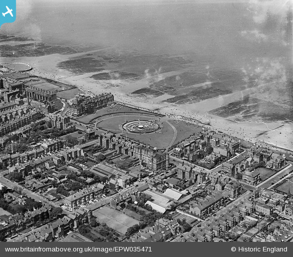
EPW035471 ENGLAND (1931). The Oval and environs, Margate, 1931
© Copyright OpenStreetMap contributors and licensed by the OpenStreetMap Foundation. 2026. Cartography is licensed as CC BY-SA.
Nearby Images (7)
EPW035471

EPW000326

EPW000628

EPW000618

EPW000617

EPW000616

EPW052888

Details
| Title | [EPW035471] The Oval and environs, Margate, 1931 |
| Reference | EPW035471 |
| Date | May-1931 |
| Link | |
| Place name | MARGATE |
| Parish | |
| District | |
| Country | ENGLAND |
| Easting / Northing | 636460, 171333 |
| Longitude / Latitude | 1.3992587469062, 51.391184316201 |
| National Grid Reference | TR365713 |
Pins
Be the first to add a comment to this image!