
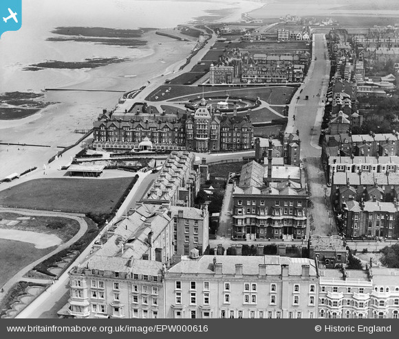
EPW000616 ENGLAND (1920). Eastern Esplanade, Margate, 1920
© Copyright OpenStreetMap contributors and licensed by the OpenStreetMap Foundation. 2026. Cartography is licensed as CC BY-SA.
Nearby Images (6)
EPW000616

EPW000617

EPW000628

EPW035471

EPW000326

EPW018603

Details
| Title | [EPW000616] Eastern Esplanade, Margate, 1920 |
| Reference | EPW000616 |
| Date | April-1920 |
| Link | |
| Place name | MARGATE |
| Parish | |
| District | |
| Country | ENGLAND |
| Easting / Northing | 636288, 171289 |
| Longitude / Latitude | 1.3967615280257, 51.390860974212 |
| National Grid Reference | TR363713 |
Pins
Be the first to add a comment to this image!