
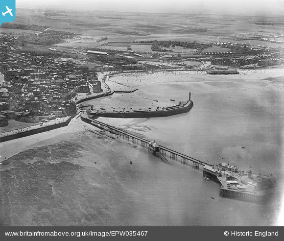
EPW035467 ENGLAND (1931). The Margate Jetty and Pier, Margate, from the north-east, 1931
© Copyright OpenStreetMap contributors and licensed by the OpenStreetMap Foundation. 2026. Cartography is licensed as CC BY-SA.
Nearby Images (18)
EPW035467

EPW000619

EPW018601

EAW015840

EPW000627

EPW048851

EPW009163

EPW048849

EPW000631

EPW048850

EPW048847

EPW018599

EAW015841

EPW000633

EPW000634

EPW048689

EPW048687

EPW048686

Details
| Title | [EPW035467] The Margate Jetty and Pier, Margate, from the north-east, 1931 |
| Reference | EPW035467 |
| Date | May-1931 |
| Link | |
| Place name | MARGATE |
| Parish | |
| District | |
| Country | ENGLAND |
| Easting / Northing | 635332, 171455 |
| Longitude / Latitude | 1.383154354164, 51.39274838653 |
| National Grid Reference | TR353715 |
Pins
Be the first to add a comment to this image!