
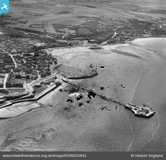
EAW015841 ENGLAND (1948). The Jetty Extension and harbour, Margate, 1948. This image has been produced from a damaged negative.
© Copyright OpenStreetMap contributors and licensed by the OpenStreetMap Foundation. 2026. Cartography is licensed as CC BY-SA.
Nearby Images (15)
EAW015841

EPW048847

EPW000162

EPW018607

EPW018599

EPW000625

EPW000631

EPW000627

EAW015840

EPW048846

EPW048845

EPW048684

EPW035467

EPW000619

EPW009241

Details
| Title | [EAW015841] The Jetty Extension and harbour, Margate, 1948. This image has been produced from a damaged negative. |
| Reference | EAW015841 |
| Date | 19-May-1948 |
| Link | |
| Place name | MARGATE |
| Parish | |
| District | |
| Country | ENGLAND |
| Easting / Northing | 635235, 171229 |
| Longitude / Latitude | 1.3816127442716, 51.390759802323 |
| National Grid Reference | TR352712 |
Pins

Mike Floate |
Sunday 27th of April 2014 08:03:57 PM |