
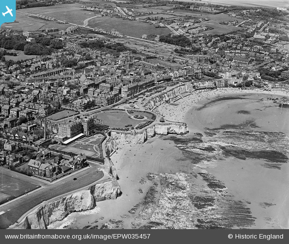
EPW035457 ENGLAND (1931). Viking Bay, Victoria Gardens, Louisa Bay and the town, Broadstairs, 1931
© Copyright OpenStreetMap contributors and licensed by the OpenStreetMap Foundation. 2026. Cartography is licensed as CC BY-SA.
Nearby Images (23)
EPW035457

EAW015845

EAW015844

EPW000344

EPW000611

EAW024845

EPW052894

EAW024846

EPW009185

EPW009184

EAW015846

EPW035455

EPW035459

EAW015847

EPW035456

EPW000609

EPW042844

EPW000605

EPW000607

EPW000606

EPW000118

EAW024847

EAW024848

Details
| Title | [EPW035457] Viking Bay, Victoria Gardens, Louisa Bay and the town, Broadstairs, 1931 |
| Reference | EPW035457 |
| Date | May-1931 |
| Link | |
| Place name | BROADSTAIRS |
| Parish | BROADSTAIRS AND ST. PETERS |
| District | |
| Country | ENGLAND |
| Easting / Northing | 639780, 167555 |
| Longitude / Latitude | 1.4443449714332, 51.355878380253 |
| National Grid Reference | TR398676 |
Pins
Be the first to add a comment to this image!