
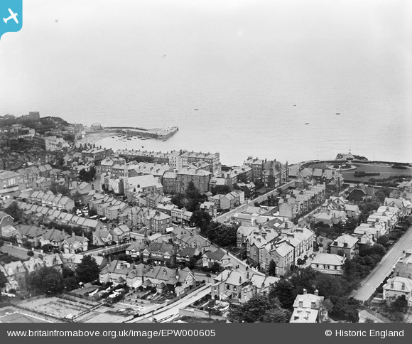
EPW000605 ENGLAND (1920). Broadstairs, from the west, 1920
© Copyright OpenStreetMap contributors and licensed by the OpenStreetMap Foundation. 2026. Cartography is licensed as CC BY-SA.
Nearby Images (7)
EPW000605

EPW000606

EPW000611

EPW052894

EPW000344

EPW035457

EAW015845

Details
| Title | [EPW000605] Broadstairs, from the west, 1920 |
| Reference | EPW000605 |
| Date | April-1920 |
| Link | |
| Place name | BROADSTAIRS |
| Parish | BROADSTAIRS AND ST. PETERS |
| District | |
| Country | ENGLAND |
| Easting / Northing | 639537, 167561 |
| Longitude / Latitude | 1.4408651744659, 51.35603472773 |
| National Grid Reference | TR395676 |
Pins

Kent Boy |
Sunday 3rd of August 2014 12:22:16 AM | |
|
Kent Boy |
Sunday 3rd of August 2014 12:20:30 AM | |
|
Kent Boy |
Sunday 3rd of August 2014 12:20:03 AM | |
|
bw86 |
Tuesday 3rd of July 2012 12:51:08 AM | |
|
bw86 |
Tuesday 3rd of July 2012 12:50:53 AM | |
|
bw86 |
Tuesday 3rd of July 2012 12:50:27 AM |