
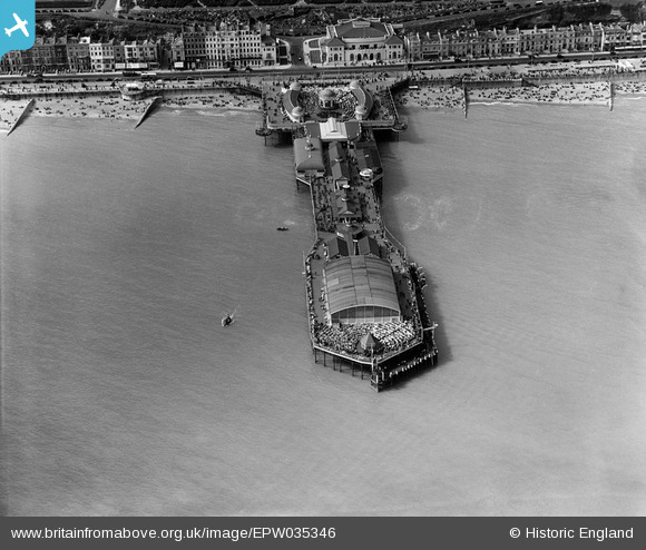
EPW035346 ENGLAND (1931). The pier, Hastings, 1931
© Copyright OpenStreetMap contributors and licensed by the OpenStreetMap Foundation. 2026. Cartography is licensed as CC BY-SA.
Nearby Images (22)
EPW035346

EPW042840

EPW035345

EAW006618

EAW030089

EPW026188

EAW002408

EPW000060B

EAW002409

EPW039390

EPW035334

EAW006619

EAW022975

EPW026200

EPW039388

EPW035342

EPW035339

EAW002407

EPW026209

EAW002410

EPW026191

EPW042839

Details
| Title | [EPW035346] The pier, Hastings, 1931 |
| Reference | EPW035346 |
| Date | 25-May-1931 |
| Link | |
| Place name | HASTINGS |
| Parish | |
| District | |
| Country | ENGLAND |
| Easting / Northing | 581188, 108912 |
| Longitude / Latitude | 0.57431679250617, 50.85074902759 |
| National Grid Reference | TQ812089 |
Pins
Be the first to add a comment to this image!