
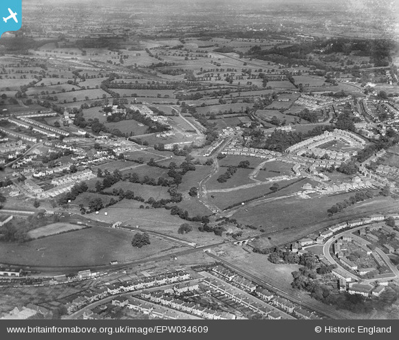
EPW034609 ENGLAND (1930). A new housing estate under construction near Lower Hale, Edgware, from the south-west, 1930
© Copyright OpenStreetMap contributors and licensed by the OpenStreetMap Foundation. 2026. Cartography is licensed as CC BY-SA.
Nearby Images (16)
EPW034609

EPW009349

EAW020694

EPW034610

EPW034615

EPW034613

EPW034561

EPW034564

EPW034614

EPW034554

EPW034562

EPW009374

EPW031554

EPW034620

EPW031551

EPW015770

Details
| Title | [EPW034609] A new housing estate under construction near Lower Hale, Edgware, from the south-west, 1930 |
| Reference | EPW034609 |
| Date | 16-October-1930 |
| Link | |
| Place name | EDGWARE |
| Parish | |
| District | |
| Country | ENGLAND |
| Easting / Northing | 519801, 191780 |
| Longitude / Latitude | -0.26962202435714, 51.611616928 |
| National Grid Reference | TQ198918 |
Pins
Be the first to add a comment to this image!