
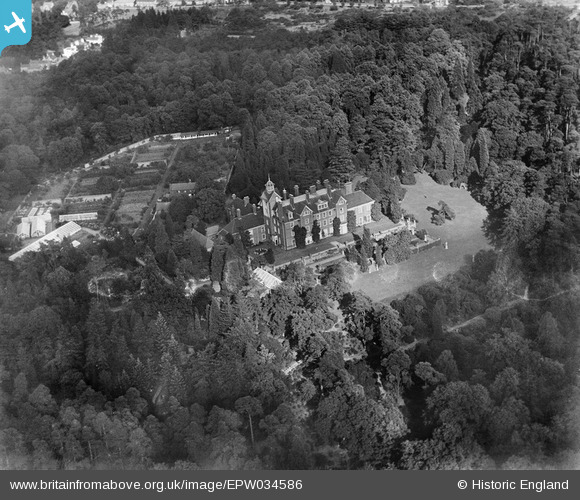
EPW034586 ENGLAND (1930). Brooklands House, Weybridge, 1930
© Copyright OpenStreetMap contributors and licensed by the OpenStreetMap Foundation. 2025. Cartography is licensed as CC BY-SA.
Nearby Images (5)
EPW034586

EPW034585

EPW034584

EPW034583

EPW016859

Details
| Title | [EPW034586] Brooklands House, Weybridge, 1930 |
| Reference | EPW034586 |
| Date | August-1930 |
| Link | |
| Place name | WEYBRIDGE |
| Parish | |
| District | |
| Country | ENGLAND |
| Easting / Northing | 506945, 163714 |
| Longitude / Latitude | -0.46373827473762, 51.36191355244 |
| National Grid Reference | TQ069637 |
Pins
Be the first to add a comment to this image!
User Comment Contributions
Now houses Brooklands College! |

Good Old Uncle Ted |
Friday 3rd of May 2013 01:14:45 PM |