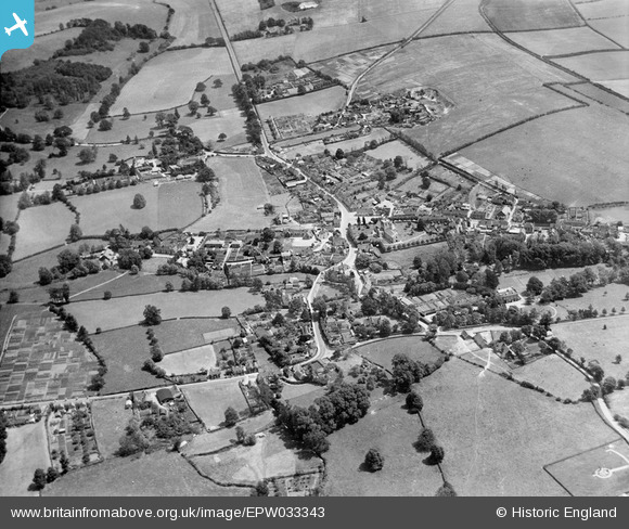
EPW033343 ENGLAND (1930). The village, Kingsclere, 1930
© Copyright OpenStreetMap contributors and licensed by the OpenStreetMap Foundation. 2025. Cartography is licensed as CC BY-SA.
Nearby Images (10)
Details
| Title | [EPW033343] The village, Kingsclere, 1930 |
| Reference | EPW033343 |
| Date | July-1930 |
| Link | |
| Place name | KINGSCLERE |
| Parish | KINGSCLERE |
| District | |
| Country | ENGLAND |
| Easting / Northing | 452524, 158750 |
| Longitude / Latitude | -1.2461165656505, 51.324919648981 |
| National Grid Reference | SU525588 |
Pins
 Gareth Martin |
Tuesday 26th of March 2013 09:59:36 PM |


![[EPW033343] The village, Kingsclere, 1930](http://britainfromabove.org.uk/sites/all/libraries/aerofilms-images/public/100x100/EPW/033/EPW033343.jpg)
![[EPW023283] St Mary's Church and the town centre, Kingsclere, 1928](http://britainfromabove.org.uk/sites/all/libraries/aerofilms-images/public/100x100/EPW/023/EPW023283.jpg)
![[EPW033341] St Mary's Church, the Market Place and George Street, Kingsclere, 1930](http://britainfromabove.org.uk/sites/all/libraries/aerofilms-images/public/100x100/EPW/033/EPW033341.jpg)
![[EPW023286] St Mary's Church, Kingsclere, 1928](http://britainfromabove.org.uk/sites/all/libraries/aerofilms-images/public/100x100/EPW/023/EPW023286.jpg)
![[EPW023284] The village centre, Kingsclere, 1928](http://britainfromabove.org.uk/sites/all/libraries/aerofilms-images/public/100x100/EPW/023/EPW023284.jpg)
![[EPW033345] The village and surrounding countryside, Kingsclere, 1930](http://britainfromabove.org.uk/sites/all/libraries/aerofilms-images/public/100x100/EPW/033/EPW033345.jpg)
![[EPW023285] The village centre, Kingsclere, 1928](http://britainfromabove.org.uk/sites/all/libraries/aerofilms-images/public/100x100/EPW/023/EPW023285.jpg)
![[EPW033344] St Mary's Church and George Street, Kingsclere, 1930](http://britainfromabove.org.uk/sites/all/libraries/aerofilms-images/public/100x100/EPW/033/EPW033344.jpg)
![[EPW033342] St Mary's Church and Swan Street, Kingsclere, 1930](http://britainfromabove.org.uk/sites/all/libraries/aerofilms-images/public/100x100/EPW/033/EPW033342.jpg)
![[EPW023282] Kingsclere and surroundings, Kingsclere, from the north, 1928](http://britainfromabove.org.uk/sites/all/libraries/aerofilms-images/public/100x100/EPW/023/EPW023282.jpg)
.jpg?itok=fumjmOu6)