
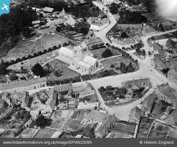
EPW023286 ENGLAND (1928). St Mary's Church, Kingsclere, 1928
© Copyright OpenStreetMap contributors and licensed by the OpenStreetMap Foundation. 2025. Cartography is licensed as CC BY-SA.
Nearby Images (9)
EPW023286

EPW023284

EPW023285

EPW023283

EPW033341

EPW033345

EPW033343

EPW033344

EPW033342

Details
| Title | [EPW023286] St Mary's Church, Kingsclere, 1928 |
| Reference | EPW023286 |
| Date | September-1928 |
| Link | |
| Place name | KINGSCLERE |
| Parish | KINGSCLERE |
| District | |
| Country | ENGLAND |
| Easting / Northing | 452535, 158652 |
| Longitude / Latitude | -1.2459731471847, 51.32403741702 |
| National Grid Reference | SU525587 |
Pins
Be the first to add a comment to this image!