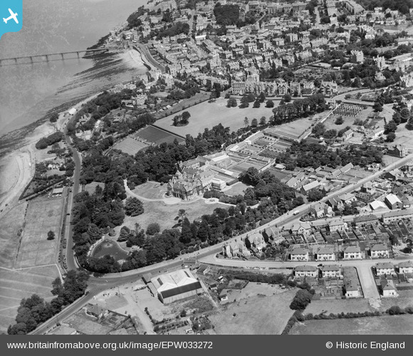
EPW033272 ENGLAND (1930). Clevedon Road and environs, Clevedon, 1930
© Copyright OpenStreetMap contributors and licensed by the OpenStreetMap Foundation. 2026. Cartography is licensed as CC BY-SA.
Nearby Images (6)
Details
| Title | [EPW033272] Clevedon Road and environs, Clevedon, 1930 |
| Reference | EPW033272 |
| Date | July-1930 |
| Link | |
| Place name | CLEVEDON |
| Parish | CLEVEDON |
| District | |
| Country | ENGLAND |
| Easting / Northing | 340087, 171162 |
| Longitude / Latitude | -2.8620206252178, 51.435793774672 |
| National Grid Reference | ST401712 |
Pins

PFC |
Saturday 21st of February 2015 06:11:41 PM | |

Class31 |
Monday 4th of February 2013 05:02:00 PM | |

Class31 |
Friday 1st of February 2013 09:53:04 PM | |

Class31 |
Friday 1st of February 2013 09:51:08 PM | |

Class31 |
Friday 1st of February 2013 09:50:27 PM | |

Class31 |
Friday 1st of February 2013 09:49:49 PM | |

Class31 |
Friday 1st of February 2013 09:14:01 PM |


![[EPW033272] Clevedon Road and environs, Clevedon, 1930](http://britainfromabove.org.uk/sites/all/libraries/aerofilms-images/public/100x100/EPW/033/EPW033272.jpg)
![[EPW024059] Clevedon Hall, Clevedon, 1928](http://britainfromabove.org.uk/sites/all/libraries/aerofilms-images/public/100x100/EPW/024/EPW024059.jpg)
![[EAW023255] St Brandon's School (Clevedon Hall), Clevedon, 1949. This image was marked by Aerofilms Ltd for photo editing.](http://britainfromabove.org.uk/sites/all/libraries/aerofilms-images/public/100x100/EAW/023/EAW023255.jpg)
![[EAW023254] St Brandon's School (Clevedon Hall) and environs, Clevedon, 1949. This image was marked by Aerofilms Ltd for photo editing.](http://britainfromabove.org.uk/sites/all/libraries/aerofilms-images/public/100x100/EAW/023/EAW023254.jpg)
![[EAW023253] St Brandon's School (Clevedon Hall) and environs, Clevedon, 1949. This image was marked by Aerofilms Ltd for photo editing.](http://britainfromabove.org.uk/sites/all/libraries/aerofilms-images/public/100x100/EAW/023/EAW023253.jpg)
![[EPW024070] Elton Road and environs, Clevedon, 1928](http://britainfromabove.org.uk/sites/all/libraries/aerofilms-images/public/100x100/EPW/024/EPW024070.jpg)