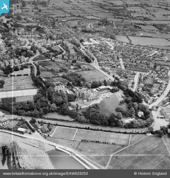
EAW023253 ENGLAND (1949). St Brandon's School (Clevedon Hall) and environs, Clevedon, 1949. This image was marked by Aerofilms Ltd for photo editing.
© Copyright OpenStreetMap contributors and licensed by the OpenStreetMap Foundation. 2026. Cartography is licensed as CC BY-SA.
Nearby Images (6)
EAW023253
 and environs, Clevedon, 1949. This image was marked by Aerofilms Ltd for photo editing.")
EAW023254
 and environs, Clevedon, 1949. This image was marked by Aerofilms Ltd for photo editing.")
EPW033272

EAW023255
, Clevedon, 1949. This image was marked by Aerofilms Ltd for photo editing.")
EPW024059

EPW024070

Details
| Title | [EAW023253] St Brandon's School (Clevedon Hall) and environs, Clevedon, 1949. This image was marked by Aerofilms Ltd for photo editing. |
| Reference | EAW023253 |
| Date | 23-May-1949 |
| Link | |
| Place name | CLEVEDON |
| Parish | CLEVEDON |
| District | |
| Country | ENGLAND |
| Easting / Northing | 340154, 171116 |
| Longitude / Latitude | -2.8610489781158, 51.435387245136 |
| National Grid Reference | ST402711 |
Pins

Matt Aldred edob.mattaldred.com |
Sunday 2nd of March 2025 10:20:38 PM | |
|
Matt Aldred edob.mattaldred.com |
Thursday 14th of March 2024 12:07:55 PM | |

Class31 |
Saturday 21st of February 2015 08:22:08 PM | |
|
Class31 |
Saturday 21st of February 2015 08:20:38 PM | |
|
Class31 |
Saturday 21st of February 2015 08:19:13 PM | |
|
Class31 |
Saturday 21st of February 2015 08:16:19 PM | |
|
Class31 |
Saturday 21st of February 2015 08:15:17 PM | |
|
Class31 |
Saturday 21st of February 2015 08:13:53 PM | |

gBr |
Thursday 31st of July 2014 08:17:40 PM | |
|
gBr |
Thursday 31st of July 2014 08:04:08 PM | |
|
gBr |
Thursday 31st of July 2014 07:58:43 PM | |
|
gBr |
Thursday 31st of July 2014 07:53:51 PM |