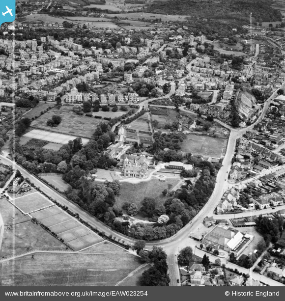
EAW023254 ENGLAND (1949). St Brandon's School (Clevedon Hall) and environs, Clevedon, 1949. This image was marked by Aerofilms Ltd for photo editing.
© Copyright OpenStreetMap contributors and licensed by the OpenStreetMap Foundation. 2026. Cartography is licensed as CC BY-SA.
Nearby Images (6)
Details
| Title | [EAW023254] St Brandon's School (Clevedon Hall) and environs, Clevedon, 1949. This image was marked by Aerofilms Ltd for photo editing. |
| Reference | EAW023254 |
| Date | 23-May-1949 |
| Link | |
| Place name | CLEVEDON |
| Parish | CLEVEDON |
| District | |
| Country | ENGLAND |
| Easting / Northing | 340151, 171170 |
| Longitude / Latitude | -2.8611012657574, 51.435872473962 |
| National Grid Reference | ST402712 |
Pins

Matt Aldred edob.mattaldred.com |
Sunday 2nd of March 2025 10:20:29 PM | |

Matt Aldred edob.mattaldred.com |
Thursday 14th of March 2024 12:08:32 PM |


![[EAW023254] St Brandon's School (Clevedon Hall) and environs, Clevedon, 1949. This image was marked by Aerofilms Ltd for photo editing.](http://britainfromabove.org.uk/sites/all/libraries/aerofilms-images/public/100x100/EAW/023/EAW023254.jpg)
![[EAW023253] St Brandon's School (Clevedon Hall) and environs, Clevedon, 1949. This image was marked by Aerofilms Ltd for photo editing.](http://britainfromabove.org.uk/sites/all/libraries/aerofilms-images/public/100x100/EAW/023/EAW023253.jpg)
![[EPW033272] Clevedon Road and environs, Clevedon, 1930](http://britainfromabove.org.uk/sites/all/libraries/aerofilms-images/public/100x100/EPW/033/EPW033272.jpg)
![[EPW024059] Clevedon Hall, Clevedon, 1928](http://britainfromabove.org.uk/sites/all/libraries/aerofilms-images/public/100x100/EPW/024/EPW024059.jpg)
![[EAW023255] St Brandon's School (Clevedon Hall), Clevedon, 1949. This image was marked by Aerofilms Ltd for photo editing.](http://britainfromabove.org.uk/sites/all/libraries/aerofilms-images/public/100x100/EAW/023/EAW023255.jpg)
![[EPW024070] Elton Road and environs, Clevedon, 1928](http://britainfromabove.org.uk/sites/all/libraries/aerofilms-images/public/100x100/EPW/024/EPW024070.jpg)