
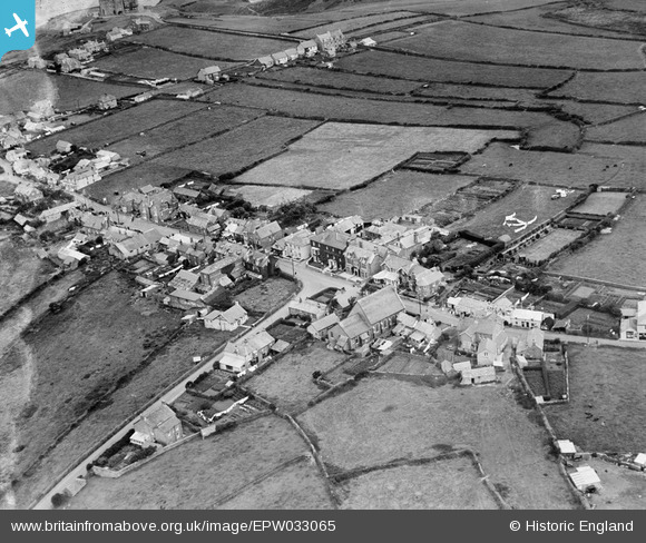
EPW033065 ENGLAND (1930). The junction of Fore Street and Molesworth Street, Tintagel, 1930
© Copyright OpenStreetMap contributors and licensed by the OpenStreetMap Foundation. 2026. Cartography is licensed as CC BY-SA.
Nearby Images (6)
EPW033065

EAW020261

EAW020263

EPW033066

EPW033067

EPW033064

Details
| Title | [EPW033065] The junction of Fore Street and Molesworth Street, Tintagel, 1930 |
| Reference | EPW033065 |
| Date | July-1930 |
| Link | |
| Place name | TINTAGEL |
| Parish | TINTAGEL |
| District | |
| Country | ENGLAND |
| Easting / Northing | 205751, 88421 |
| Longitude / Latitude | -4.7488537985647, 50.662434567849 |
| National Grid Reference | SX058884 |
Pins

Andy Burton |
Thursday 24th of July 2014 02:47:30 PM | |
|
piglittel |
Saturday 11th of May 2013 05:32:08 PM | |
|
piglittel |
Saturday 11th of May 2013 05:30:12 PM | |
|
piglittel |
Saturday 11th of May 2013 05:28:40 PM | |
|
piglittel |
Saturday 11th of May 2013 05:27:41 PM | |
|
piglittel |
Saturday 11th of May 2013 05:27:10 PM | |
|
piglittel |
Saturday 11th of May 2013 05:26:01 PM |