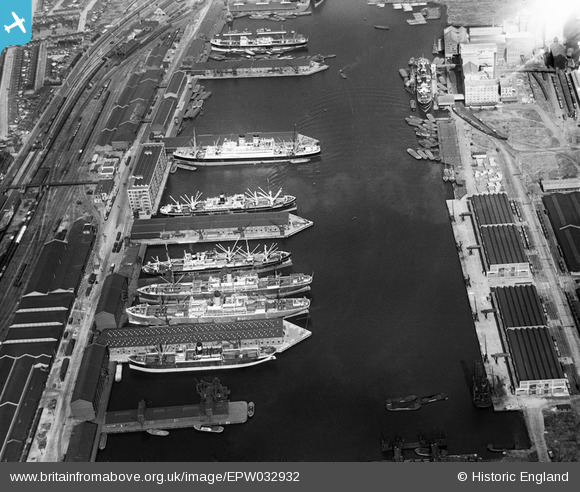
EPW032932 ENGLAND (1930). The Royal Victoria Dock, Custom House, 1930
© Copyright OpenStreetMap contributors and licensed by the OpenStreetMap Foundation. 2026. Cartography is licensed as CC BY-SA.
Nearby Images (26)
EPW032932

EAW021714

EPW008888

EPW032934

EAW035771

EAW035972

EAW016656

EAW008822

EAW035766

EPR000001

EPW055308

EAW035969

EAW035765

EPW059357A

EAW035975

EAW035769

EAW035770

EAW035971

EPW032928

EPW008883

EPW053180

EPW053181

EPW053182

EPW053179

EAW035763

EAW035963

Details
| Title | [EPW032932] The Royal Victoria Dock, Custom House, 1930 |
| Reference | EPW032932 |
| Date | June-1930 |
| Link | |
| Place name | CUSTOM HOUSE |
| Parish | |
| District | |
| Country | ENGLAND |
| Easting / Northing | 540852, 180682 |
| Longitude / Latitude | 0.029796601016575, 51.507008399275 |
| National Grid Reference | TQ409807 |
Pins
Be the first to add a comment to this image!