
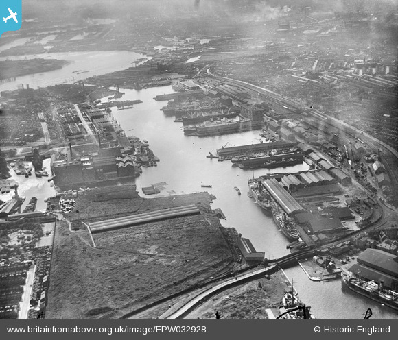
EPW032928 ENGLAND (1930). The Royal Victoria Dock, Custom House, 1930
© Copyright OpenStreetMap contributors and licensed by the OpenStreetMap Foundation. 2026. Cartography is licensed as CC BY-SA.
Nearby Images (25)
EPW032928

EPW059357A

EPW008883

EAW035771

EPW053027

EAW000056

EPW044123

EAW035763

EAW035963

EPW053179

EPW053182

EPW053181

EPW053180

EPW008888

EAW021714

EPW005308

EAW035760

EPW053024

EPW032932

EPW053026

EAW021715

EAW035766

EPW053056

EAW035770

EAW035975

Details
| Title | [EPW032928] The Royal Victoria Dock, Custom House, 1930 |
| Reference | EPW032928 |
| Date | June-1930 |
| Link | |
| Place name | CUSTOM HOUSE |
| Parish | |
| District | |
| Country | ENGLAND |
| Easting / Northing | 541099, 180634 |
| Longitude / Latitude | 0.033334462891169, 51.506515402763 |
| National Grid Reference | TQ411806 |
Pins
Be the first to add a comment to this image!