
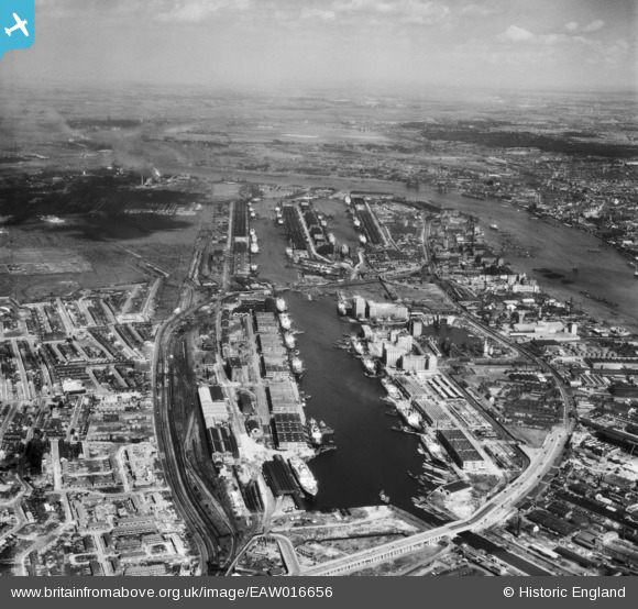
EAW016656 ENGLAND (1948). The Royal Docks, Canning Town, from the west, 1948
© Copyright OpenStreetMap contributors and licensed by the OpenStreetMap Foundation. 2026. Cartography is licensed as CC BY-SA.
Nearby Images (30)
EAW016656

EPR000001

EPW032934

EAW008822

EAW035765

EAW035972

EPW032932

EAW021714

EAW016655

EPW055308

EAW035766

EPW044120

EPW046150

EAW035969

EPW008888

EAW035771

EAW035973

EAW035769

EAW035768

EAW035974

EAW035975

EAW035971

EPW032933

EPW008889

EAW035970

EPW046153

EAW035770

EAW000053

EPW053026

EPW053056

Details
| Title | [EAW016656] The Royal Docks, Canning Town, from the west, 1948 |
| Reference | EAW016656 |
| Date | 17-June-1948 |
| Link | |
| Place name | CANNING TOWN |
| Parish | |
| District | |
| Country | ENGLAND |
| Easting / Northing | 540719, 180632 |
| Longitude / Latitude | 0.027861295353671, 51.506592196358 |
| National Grid Reference | TQ407806 |
Pins
Be the first to add a comment to this image!