
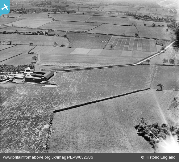
EPW032586 ENGLAND (1930). Trial plots and cultivated fields around Ash House Lane, Little Leigh, from the north-east, 1930
© Copyright OpenStreetMap contributors and licensed by the OpenStreetMap Foundation. 2026. Cartography is licensed as CC BY-SA.
Nearby Images (17)
EPW032586

EAW030039

EAW030017

EAW030038

EAW030037

EAW030036

EAW030018

EAW001904

EAW030043

EAW001901

EAW001903

EPW032591

EAW001902

EAW001899

EAW030041

EAW017281

EAW017280

Details
| Title | [EPW032586] Trial plots and cultivated fields around Ash House Lane, Little Leigh, from the north-east, 1930 |
| Reference | EPW032586 |
| Date | June-1930 |
| Link | |
| Place name | LITTLE LEIGH |
| Parish | LITTLE LEIGH |
| District | |
| Country | ENGLAND |
| Easting / Northing | 361540, 377517 |
| Longitude / Latitude | -2.5770571292854, 53.292942494027 |
| National Grid Reference | SJ615775 |
Pins

Class31 |
Thursday 28th of February 2013 06:13:02 PM | |
|
Class31 |
Thursday 28th of February 2013 06:12:29 PM | |

Dylan Moore |
Thursday 28th of February 2013 05:43:26 PM | |
|
Dylan Moore |
Thursday 28th of February 2013 05:42:30 PM | |
Well done Dylan for getting this one. This gives you 13 photos in the same area. I had searched the area but failed to identify the location. Excellent that you have identified them. |
Class31 |
Thursday 28th of February 2013 06:22:03 PM |
I whole-heartedly agree Class31, this is a great job by Dylan and makes a big difference. Having a location for images means that people can find archive material for places that they are interested in. Yours, Katy Britain from Above Cataloguing Team Leader |
Katy Whitaker |
Thursday 7th of March 2013 04:56:52 PM |
User Comment Contributions
View looking south. |
Class31 |
Thursday 28th of February 2013 06:14:30 PM |