
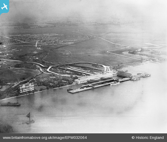
EPW032064 ENGLAND (1930). Tilbury Fort (later Tilbury Riverside) railway station and environs, Tilbury, 1930
© Copyright OpenStreetMap contributors and licensed by the OpenStreetMap Foundation. 2026. Cartography is licensed as CC BY-SA.
Nearby Images (8)
EPW032064
 railway station and environs, Tilbury, 1930")
EPW044217

EPW044223

EPW032061
 railway station and environs, Tilbury, 1930")
EAW014601

EPW024911

EPW032065
 railway station and environs, Tilbury, 1930")
EPW032063
 railway station and environs, Tilbury, 1930")
Details
| Title | [EPW032064] Tilbury Fort (later Tilbury Riverside) railway station and environs, Tilbury, 1930 |
| Reference | EPW032064 |
| Date | May-1930 |
| Link | |
| Place name | TILBURY |
| Parish | |
| District | |
| Country | ENGLAND |
| Easting / Northing | 564465, 175342 |
| Longitude / Latitude | 0.36730297469428, 51.452650276441 |
| National Grid Reference | TQ645753 |
Pins
Be the first to add a comment to this image!
User Comment Contributions
See EPW032065. |

BigglesH |
Thursday 11th of April 2013 09:00:16 PM |