
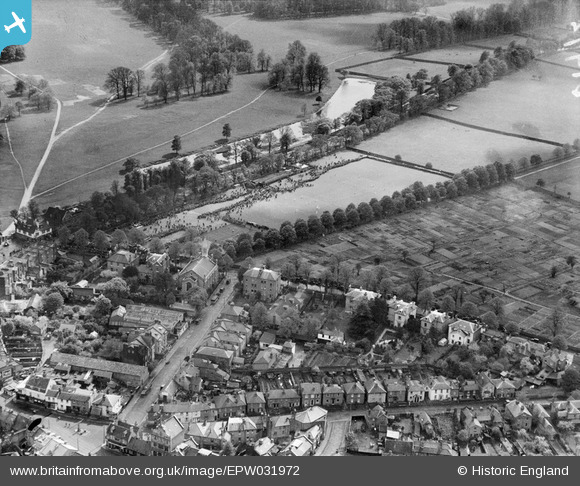
EPW031972 ENGLAND (1930). St John's Road and the King's Field Recreation Ground, Hampton Wick, 1930
© Copyright OpenStreetMap contributors and licensed by the OpenStreetMap Foundation. 2026. Cartography is licensed as CC BY-SA.
Nearby Images (14)
EPW031972

EPW031973

EPW031975

EPW031969

EPW018088

EPW031971

EPW031976

EPW001724

EPW018087

EPW031970

EPW031974

EPW001721

EPW001722

EPW001726

Details
| Title | [EPW031972] St John's Road and the King's Field Recreation Ground, Hampton Wick, 1930 |
| Reference | EPW031972 |
| Date | 12-May-1930 |
| Link | |
| Place name | HAMPTON WICK |
| Parish | |
| District | |
| Country | ENGLAND |
| Easting / Northing | 517354, 169399 |
| Longitude / Latitude | -0.31240066745162, 51.410959284851 |
| National Grid Reference | TQ174694 |
Pins

Vauni |
Tuesday 27th of January 2015 04:40:43 PM |