
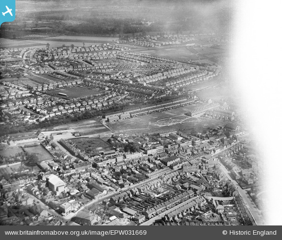
EPW031669 ENGLAND (1930). Myrtle Road and environs, Hounslow, from the south-east, 1930
© Copyright OpenStreetMap contributors and licensed by the OpenStreetMap Foundation. 2026. Cartography is licensed as CC BY-SA.
Nearby Images (3)
EPW031669

EPW023235

EPW031668

Details
| Title | [EPW031669] Myrtle Road and environs, Hounslow, from the south-east, 1930 |
| Reference | EPW031669 |
| Date | April-1930 |
| Link | |
| Place name | HOUNSLOW |
| Parish | |
| District | |
| Country | ENGLAND |
| Easting / Northing | 514053, 175782 |
| Longitude / Latitude | -0.35779228961325, 51.469009192087 |
| National Grid Reference | TQ141758 |
Pins

aeronaut |
Saturday 11th of October 2025 09:50:53 PM | |
|
Gtx_Chris |
Wednesday 21st of December 2022 10:44:08 PM | |
|
CJC |
Tuesday 27th of April 2021 06:18:20 PM | |
|
CJC |
Tuesday 27th of April 2021 06:18:03 PM | |
|
CJC |
Tuesday 27th of April 2021 06:17:29 PM | |
|
CJC |
Tuesday 27th of April 2021 06:16:50 PM |