
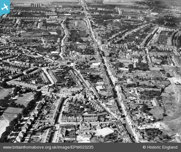
EPW023235 ENGLAND (1928). High Street and Hanworth Road, Hounslow, 1928
© Copyright OpenStreetMap contributors and licensed by the OpenStreetMap Foundation. 2026. Cartography is licensed as CC BY-SA.
Nearby Images (3)
EPW023235

EPW031669

EPW031668

Details
| Title | [EPW023235] High Street and Hanworth Road, Hounslow, 1928 |
| Reference | EPW023235 |
| Date | September-1928 |
| Link | |
| Place name | HOUNSLOW |
| Parish | |
| District | |
| Country | ENGLAND |
| Easting / Northing | 514096, 175757 |
| Longitude / Latitude | -0.35718149442166, 51.468775800359 |
| National Grid Reference | TQ141758 |
Pins

R6ece |
Wednesday 19th of November 2025 08:58:10 AM | |
|
R6ece |
Wednesday 19th of November 2025 08:56:12 AM | |
|
paul |
Sunday 28th of February 2021 05:19:50 PM | |
|
Isleworth1961 |
Saturday 27th of January 2018 02:27:48 PM | |

Des Elmes |
Wednesday 6th of April 2016 08:22:27 PM | |

Class31 |
Wednesday 17th of July 2013 10:01:50 AM | |
|
Ellieann |
Monday 27th of August 2012 01:55:53 PM | |
|
Ellieann |
Monday 27th of August 2012 01:55:18 PM | |
|
Ellieann |
Monday 27th of August 2012 01:54:58 PM | |
|
John |
Sunday 5th of August 2012 11:50:38 PM | |
|
Isleworth1961 |
Wednesday 25th of July 2012 12:18:04 PM | |
|
librarian |
Saturday 14th of July 2012 07:28:31 PM | |
|
librarian |
Saturday 14th of July 2012 07:28:06 PM | |
|
Isleworth1961 |
Friday 13th of July 2012 10:53:24 PM |
