
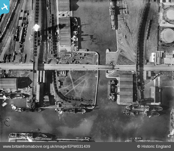
EPW031439 ENGLAND (1930). The Railway Dock, West Dock and Lower Bridge Street, Goole, 1930
© Copyright OpenStreetMap contributors and licensed by the OpenStreetMap Foundation. 2026. Cartography is licensed as CC BY-SA.
Nearby Images (4)
EPW031439

EPW031438

EAW046195

EPW031429

Details
| Title | [EPW031439] The Railway Dock, West Dock and Lower Bridge Street, Goole, 1930 |
| Reference | EPW031439 |
| Date | February-1930 |
| Link | |
| Place name | GOOLE |
| Parish | GOOLE |
| District | |
| Country | ENGLAND |
| Easting / Northing | 474352, 423349 |
| Longitude / Latitude | -0.87363642217332, 53.701048375032 |
| National Grid Reference | SE744233 |
Pins

John Wass |
Thursday 4th of January 2018 04:30:13 PM | |
|
Davethe |
Thursday 24th of July 2014 11:35:47 AM | |
|
Davethe |
Thursday 24th of July 2014 11:35:21 AM | |
|
Davethe |
Thursday 24th of July 2014 11:34:04 AM |