
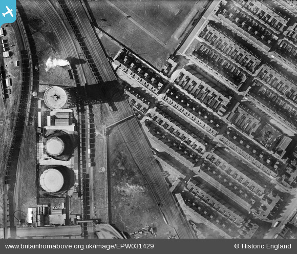
EPW031429 ENGLAND (1930). The Goole Council Water Works and terraced housing surrounding Jefferson Street, Goole, 1930
© Copyright OpenStreetMap contributors and licensed by the OpenStreetMap Foundation. 2026. Cartography is licensed as CC BY-SA.
Nearby Images (4)
EPW031429

EPW031430

EPW031428

EPW031439

Details
| Title | [EPW031429] The Goole Council Water Works and terraced housing surrounding Jefferson Street, Goole, 1930 |
| Reference | EPW031429 |
| Date | February-1930 |
| Link | |
| Place name | GOOLE |
| Parish | GOOLE |
| District | |
| Country | ENGLAND |
| Easting / Northing | 474142, 423594 |
| Longitude / Latitude | -0.87675841570554, 53.703280159499 |
| National Grid Reference | SE741236 |
Pins

Davethe |
Thursday 24th of July 2014 11:49:30 AM | |
|
Davethe |
Thursday 24th of July 2014 11:49:01 AM | |
|
Davethe |
Thursday 24th of July 2014 11:48:33 AM | |
|
Davethe |
Thursday 24th of July 2014 11:47:58 AM | |
|
Davethe |
Thursday 24th of July 2014 11:45:52 AM | |
|
Davethe |
Thursday 24th of July 2014 11:45:13 AM |