
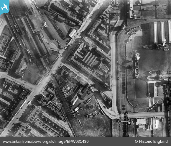
EPW031430 ENGLAND (1930). Goole Railway Station, Booth Ferry Road and the Railway Dock, Goole, 1930
© Copyright OpenStreetMap contributors and licensed by the OpenStreetMap Foundation. 2026. Cartography is licensed as CC BY-SA.
Nearby Images (4)
EPW031430

EPW012839

EPW031429

EPW031431

Details
| Title | [EPW031430] Goole Railway Station, Booth Ferry Road and the Railway Dock, Goole, 1930 |
| Reference | EPW031430 |
| Date | February-1930 |
| Link | |
| Place name | GOOLE |
| Parish | GOOLE |
| District | |
| Country | ENGLAND |
| Easting / Northing | 474378, 423646 |
| Longitude / Latitude | -0.87317132007006, 53.703713934532 |
| National Grid Reference | SE744236 |
Pins

Brian |
Monday 7th of December 2020 09:14:12 PM | |
|
John Wass |
Thursday 4th of January 2018 04:24:58 PM | |
|
John Wass |
Thursday 4th of January 2018 04:22:19 PM | |
|
John Wass |
Thursday 4th of January 2018 04:18:54 PM |
User Comment Contributions
Goole Railway Station, Boothferry Road, showing Stanhope Dock and north end of Railway Dock, Goole |
IanB |
Monday 10th of November 2014 03:15:24 AM |