
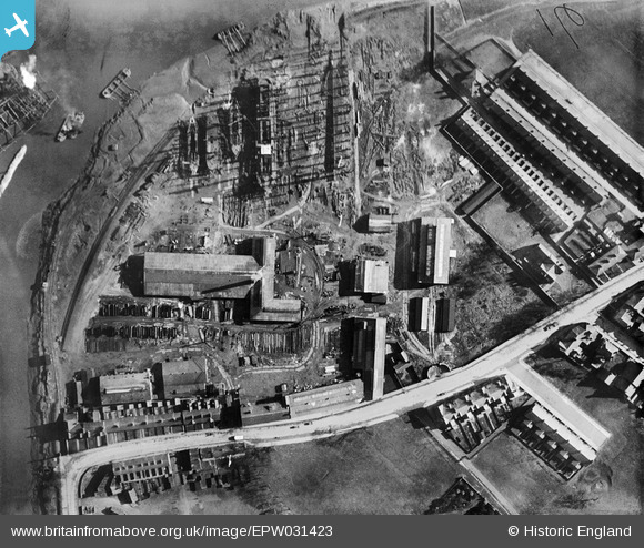
EPW031423 ENGLAND (1930). The Groves Ship Yard and Swinefleet Road, Old Goole, 1930
© Copyright OpenStreetMap contributors and licensed by the OpenStreetMap Foundation. 2026. Cartography is licensed as CC BY-SA.
Nearby Images (25)
EPW031423

EAW030604

EAW030612

EAW030610

EAW030606

EAW030609

EAW030613

EAW030611

EAW030615

EAW030603

EAW030605

EAW030616

EAW030608

EAW030614

EAW030607

EPW031447

EAW022512

EPW031445

EAW046156

EPW031444

EPW031446

EAW022515

EPW031449

EPW031424

EPW031452

Details
| Title | [EPW031423] The Groves Ship Yard and Swinefleet Road, Old Goole, 1930 |
| Reference | EPW031423 |
| Date | February-1930 |
| Link | |
| Place name | OLD GOOLE |
| Parish | GOOLE |
| District | |
| Country | ENGLAND |
| Easting / Northing | 474855, 422678 |
| Longitude / Latitude | -0.86618017489304, 53.694945952582 |
| National Grid Reference | SE749227 |
Pins
Be the first to add a comment to this image!