
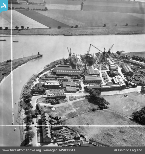
EAW030614 ENGLAND (1950). The Goole Shipbuilding and Repairing Co Ltd Works, Goole, 1950. This image was marked by Aerofilms Ltd for photo editing.
© Copyright OpenStreetMap contributors and licensed by the OpenStreetMap Foundation. 2026. Cartography is licensed as CC BY-SA.
Nearby Images (27)
EAW030614

EAW030608

EAW030605

EAW030616

EAW030611

EAW030610

EAW030609

EAW030603

EPW031423

EAW030612

EAW030604

EAW030606

EPW031445

EAW030615

EAW030613

EAW030607

EAW022512

EAW046156

EPW031449

EAW022515

EPW031447

EPW031444

EPW031446

EAW046153

EPW031452

EPW031422

EPW048854

Details
| Title | [EAW030614] The Goole Shipbuilding and Repairing Co Ltd Works, Goole, 1950. This image was marked by Aerofilms Ltd for photo editing. |
| Reference | EAW030614 |
| Date | 29-June-1950 |
| Link | |
| Place name | GOOLE |
| Parish | GOOLE |
| District | |
| Country | ENGLAND |
| Easting / Northing | 474826, 422745 |
| Longitude / Latitude | -0.86660316316727, 53.695552265063 |
| National Grid Reference | SE748227 |
Pins
Be the first to add a comment to this image!