
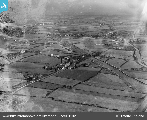
EPW031132 ENGLAND (1929). The A580 under construction, Town Lane, from the west, 1929
© Copyright OpenStreetMap contributors and licensed by the OpenStreetMap Foundation. 2026. Cartography is licensed as CC BY-SA.
Nearby Images (8)
EPW031132

EPW037207

EPW038569
 and Morley's Bridge under construction crossing the Bridgewater Canal, Town Lane, 1932. This image has been produced from a damaged negative.")
EPW037208

EPW037206

EPW038568
 and Morley's Bridge under construction crossing the Bridgewater Canal, Town Lane, from the west, 1932")
EPW037209

EPW031131

Details
| Title | [EPW031132] The A580 under construction, Town Lane, from the west, 1929 |
| Reference | EPW031132 |
| Date | October-1929 |
| Link | |
| Place name | TOWN LANE |
| Parish | |
| District | |
| Country | ENGLAND |
| Easting / Northing | 369050, 399697 |
| Longitude / Latitude | -2.4665563413031, 53.492817645881 |
| National Grid Reference | SJ691997 |
Pins

SMJ |
Wednesday 5th of December 2012 02:54:19 PM | |
|
SMJ |
Wednesday 5th of December 2012 02:51:18 PM | |
|
AD |
Friday 19th of October 2012 04:30:05 PM | |
|
AD |
Friday 19th of October 2012 04:29:37 PM |