
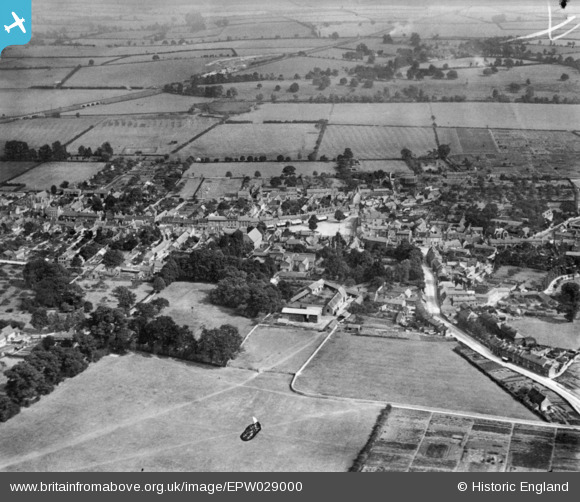
EPW029000 ENGLAND (1929). The town, Olney, 1929. This image has been produced from a copy-negative.
© Copyright OpenStreetMap contributors and licensed by the OpenStreetMap Foundation. 2026. Cartography is licensed as CC BY-SA.
Nearby Images (6)
EPW029000

EPW028995

EPW029003

EAW037768

EAW037769

EPW034323

Details
| Title | [EPW029000] The town, Olney, 1929. This image has been produced from a copy-negative. |
| Reference | EPW029000 |
| Date | 6-September-1929 |
| Link | |
| Place name | OLNEY |
| Parish | OLNEY |
| District | |
| Country | ENGLAND |
| Easting / Northing | 488886, 251317 |
| Longitude / Latitude | -0.7006662059116, 52.152564049563 |
| National Grid Reference | SP889513 |
Pins
Be the first to add a comment to this image!