
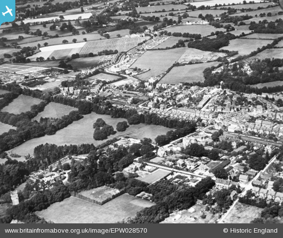
EPW028570 ENGLAND (1929). Albany Road and environs, Crawley, 1929. This image has been produced from a copy-negative.
© Copyright OpenStreetMap contributors and licensed by the OpenStreetMap Foundation. 2026. Cartography is licensed as CC BY-SA.
Nearby Images (6)
EPW028570

EAW041929

EAW011067

EPW028571

EAW037054

EAW011068

Details
| Title | [EPW028570] Albany Road and environs, Crawley, 1929. This image has been produced from a copy-negative. |
| Reference | EPW028570 |
| Date | August-1929 |
| Link | |
| Place name | CRAWLEY |
| Parish | |
| District | |
| Country | ENGLAND |
| Easting / Northing | 526156, 136522 |
| Longitude / Latitude | -0.1974888817226, 51.113557652652 |
| National Grid Reference | TQ262365 |
Pins
Be the first to add a comment to this image!