
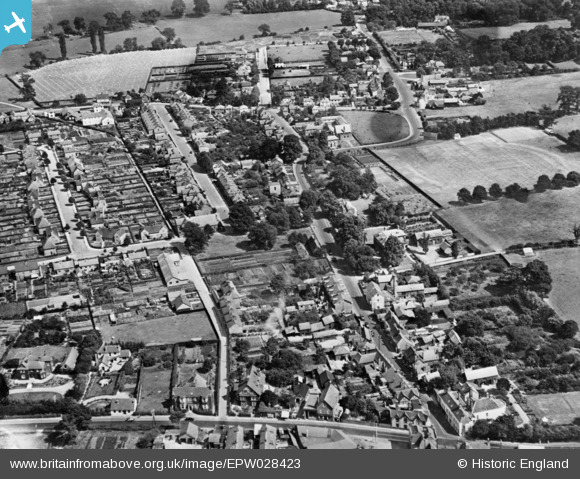
EPW028423 ENGLAND (1929). High Street and environs, Old Harlow, 1929. This image has been produced from a copy-negative.
© Copyright OpenStreetMap contributors and licensed by the OpenStreetMap Foundation. 2026. Cartography is licensed as CC BY-SA.
Nearby Images (4)
EPW028423

EAW043602

EAW001509

EAW043603

Details
| Title | [EPW028423] High Street and environs, Old Harlow, 1929. This image has been produced from a copy-negative. |
| Reference | EPW028423 |
| Date | August-1929 |
| Link | |
| Place name | OLD HARLOW |
| Parish | |
| District | |
| Country | ENGLAND |
| Easting / Northing | 547446, 211638 |
| Longitude / Latitude | 0.13780133380164, 51.783498596296 |
| National Grid Reference | TL474116 |
Pins
Be the first to add a comment to this image!