
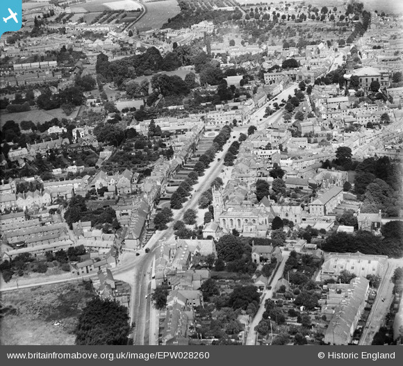
EPW028260 ENGLAND (1929). St John the Evangelist's R.C. Church and South Bar Street, Banbury, 1929
© Copyright OpenStreetMap contributors and licensed by the OpenStreetMap Foundation. 2026. Cartography is licensed as CC BY-SA.
Nearby Images (21)
EPW028260

EPW006004

EAW006312

EAW029564

EPW028261

EAW006322

EAW006314

EAW029563

EPW028255

EAW006319

EAW006318

EPW028256

EPW028252

EAW006315

EAW006321

EAW006320

EAW006316

EPW028253

EAW006313

EAW006317

EPW028257

Details
| Title | [EPW028260] St John the Evangelist's R.C. Church and South Bar Street, Banbury, 1929 |
| Reference | EPW028260 |
| Date | August-1929 |
| Link | |
| Place name | BANBURY |
| Parish | BANBURY |
| District | |
| Country | ENGLAND |
| Easting / Northing | 445303, 240283 |
| Longitude / Latitude | -1.3391616145774, 52.058654862215 |
| National Grid Reference | SP453403 |
Pins

Starman |
Sunday 1st of June 2025 03:29:44 PM | |
|
Starman |
Monday 8th of June 2020 06:59:46 PM | |
|
Starman |
Monday 8th of June 2020 06:58:38 PM | |
|
Starman |
Monday 8th of June 2020 06:56:29 PM | |

Class31 |
Thursday 13th of June 2013 08:36:22 PM |
