
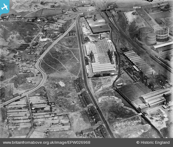
EPW026968 ENGLAND (1929). The Etruria Pottery and environs, Hartshill, 1929
© Copyright OpenStreetMap contributors and licensed by the OpenStreetMap Foundation. 2026. Cartography is licensed as CC BY-SA.
Nearby Images (22)
EPW026968

EPW026969

EPW026970

EPW026977

EPW026974

EPW026978

EPW026971

EPW023570

EPW023569

EPW023568

EPW038486

EPW038484

EPW023571

EPW038487

EPW020065

EPW038482

EPW038483

EPW038485

EAW020985

EPW038491

EAW021618

EAW021621

Details
| Title | [EPW026968] The Etruria Pottery and environs, Hartshill, 1929 |
| Reference | EPW026968 |
| Date | May-1929 |
| Link | |
| Place name | HARTSHILL |
| Parish | |
| District | |
| Country | ENGLAND |
| Easting / Northing | 386614, 346591 |
| Longitude / Latitude | -2.1995562398272, 53.016146759035 |
| National Grid Reference | SJ866466 |
