
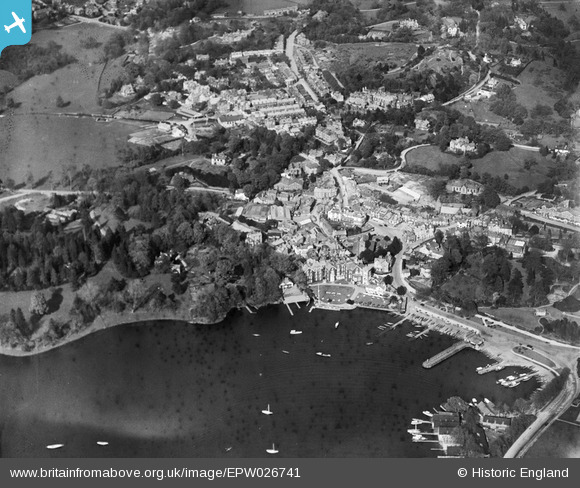
EPW026741 ENGLAND (1929). Bowness Bay and the town, Bowness-on-Windermere, 1929
© Copyright OpenStreetMap contributors and licensed by the OpenStreetMap Foundation. 2026. Cartography is licensed as CC BY-SA.
Nearby Images (14)
EPW026741

EPW026769

EPW026772

EAW023625

EPW026740

EPW025637

EAW025637

EPW004033

EPW026773

EPW004032

EAW026244

EAW025636

EAW026034

EAW025635

Details
| Title | [EPW026741] Bowness Bay and the town, Bowness-on-Windermere, 1929 |
| Reference | EPW026741 |
| Date | May-1929 |
| Link | |
| Place name | BOWNESS-ON-WINDERMERE |
| Parish | WINDERMERE |
| District | |
| Country | ENGLAND |
| Easting / Northing | 340250, 496987 |
| Longitude / Latitude | -2.9196832594407, 54.364746678638 |
| National Grid Reference | SD403970 |
Pins
Be the first to add a comment to this image!
User Comment Contributions

Bowness |

Class31 |
Saturday 22nd of June 2013 03:43:21 PM |