
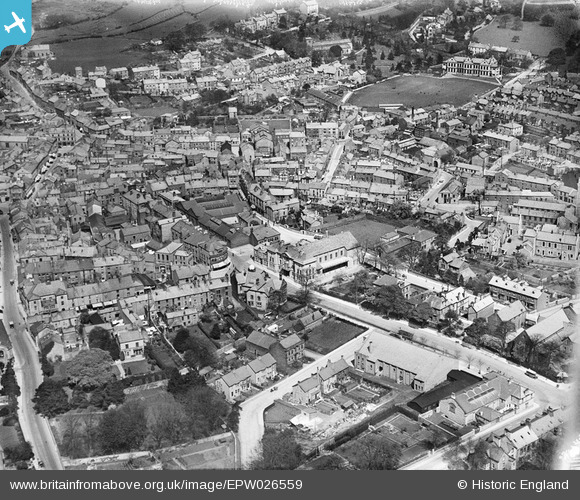
EPW026559 ENGLAND (1929). The town centre, Ulverston, 1929
© Copyright OpenStreetMap contributors and licensed by the OpenStreetMap Foundation. 2026. Cartography is licensed as CC BY-SA.
Nearby Images (7)
EPW026559

EPW026553

EPW026557

EPW026552

EPW026556

EPW026554

EPW026551

Details
| Title | [EPW026559] The town centre, Ulverston, 1929 |
| Reference | EPW026559 |
| Date | May-1929 |
| Link | |
| Place name | ULVERSTON |
| Parish | ULVERSTON |
| District | |
| Country | ENGLAND |
| Easting / Northing | 328704, 478253 |
| Longitude / Latitude | -3.0929032158256, 54.194906250733 |
| National Grid Reference | SD287783 |
