
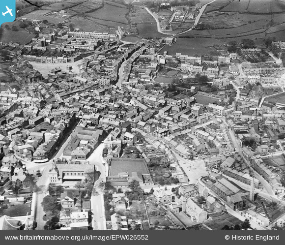
EPW026552 ENGLAND (1929). The town centre, Ulverston, 1929
© Copyright OpenStreetMap contributors and licensed by the OpenStreetMap Foundation. 2026. Cartography is licensed as CC BY-SA.
Nearby Images (7)
EPW026552

EPW026554

EPW026559

EPW026556

EPW026553

EPW026551

EPW026557

Details
| Title | [EPW026552] The town centre, Ulverston, 1929 |
| Reference | EPW026552 |
| Date | May-1929 |
| Link | |
| Place name | ULVERSTON |
| Parish | ULVERSTON |
| District | |
| Country | ENGLAND |
| Easting / Northing | 328710, 478375 |
| Longitude / Latitude | -3.0928401869235, 54.196003472208 |
| National Grid Reference | SD287784 |
Pins

ALLEN |
Wednesday 9th of November 2022 05:32:09 PM | |
|
gnombicards |
Tuesday 12th of May 2020 01:07:19 PM | |
|
MappMan |
Friday 23rd of August 2013 03:53:44 PM | |
|
MappMan |
Friday 23rd of August 2013 03:53:18 PM | |
|
Mikado |
Thursday 23rd of August 2012 10:44:41 PM |