
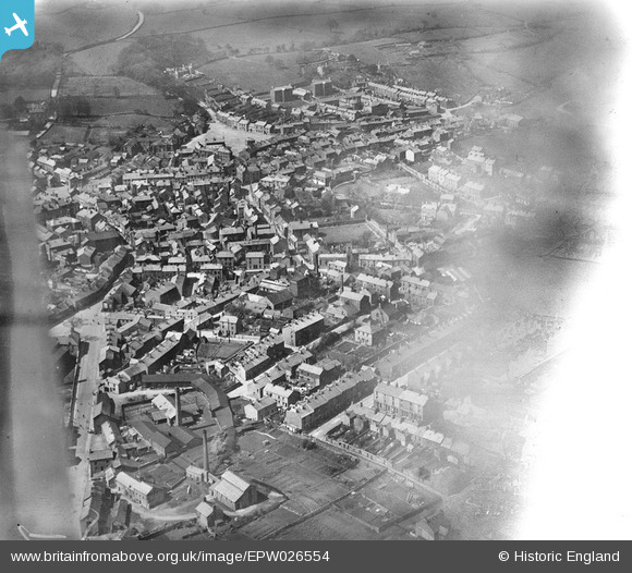
EPW026554 ENGLAND (1929). The town centre, Ulverston, 1929. This image has been affected by flare.
© Copyright OpenStreetMap contributors and licensed by the OpenStreetMap Foundation. 2026. Cartography is licensed as CC BY-SA.
Nearby Images (6)
EPW026554

EPW026552

EPW026559

EPW026558

EPW026556

EPW026553

Details
| Title | [EPW026554] The town centre, Ulverston, 1929. This image has been affected by flare. |
| Reference | EPW026554 |
| Date | May-1929 |
| Link | |
| Place name | ULVERSTON |
| Parish | ULVERSTON |
| District | |
| Country | ENGLAND |
| Easting / Northing | 328816, 478433 |
| Longitude / Latitude | -3.091229318315, 54.196539432461 |
| National Grid Reference | SD288784 |
Pins
Be the first to add a comment to this image!