
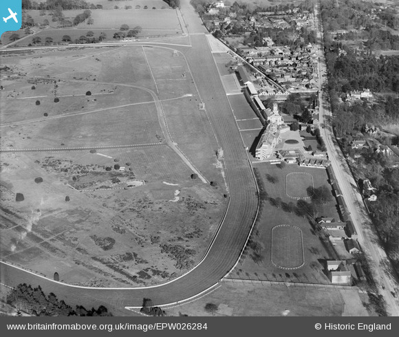
EPW026284 ENGLAND (1929). Ascot Racecourse home straight, grandstands and paddocks, Ascot, 1929
© Copyright OpenStreetMap contributors and licensed by the OpenStreetMap Foundation. 2026. Cartography is licensed as CC BY-SA.
Nearby Images (26)
EPW026284

EPW013441

EPW006706

EPW008705

EPW008715

EPW036160

EPW006704

EPW026285

EPW008709

EPW026290

EPW008704

EPW006708

EPW008716

EAW022115

EPW013401

EAW042137

EAW022117

EPW008707

EPW006707

EPW006700

EAW022116

EAW022114

EPW008711

EAW042136

EPW008708

EPW006702

Details
| Title | [EPW026284] Ascot Racecourse home straight, grandstands and paddocks, Ascot, 1929 |
| Reference | EPW026284 |
| Date | 25-April-1929 |
| Link | |
| Place name | ASCOT |
| Parish | SUNNINGHILL AND ASCOT |
| District | |
| Country | ENGLAND |
| Easting / Northing | 491881, 168993 |
| Longitude / Latitude | -0.6786990481427, 51.412010463618 |
| National Grid Reference | SU919690 |
Pins
Be the first to add a comment to this image!