
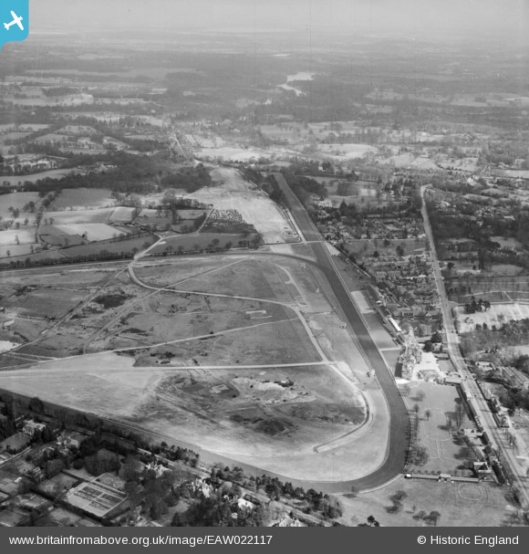
EAW022117 ENGLAND (1949). Ascot Racecourse, Ascot, from the west, 1949
© Copyright OpenStreetMap contributors and licensed by the OpenStreetMap Foundation. 2026. Cartography is licensed as CC BY-SA.
Nearby Images (29)
EAW022117

EPW013401

EPW006707

EAW042137

EPW006708

EAW022115

EPW008709

EPW006700

EPW013441

EPW026284

EAW022114

EPW008704

EPW036160

EPW008705

EPW008708

EPW026290

EPW008707

EPW006706

EPW006703

EPW026285

EPW006704

EPW006702

EPW008715

EPW008711

EAW042135

EAW042136

EPW006705

EPW008716

EAW021006

Details
| Title | [EAW022117] Ascot Racecourse, Ascot, from the west, 1949 |
| Reference | EAW022117 |
| Date | 14-April-1949 |
| Link | |
| Place name | ASCOT |
| Parish | SUNNINGHILL AND ASCOT |
| District | |
| Country | ENGLAND |
| Easting / Northing | 491948, 169142 |
| Longitude / Latitude | -0.67769717651551, 51.413339146397 |
| National Grid Reference | SU919691 |
Pins
Be the first to add a comment to this image!