
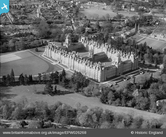
EPW026268 ENGLAND (1929). Royal Holloway College, Egham, 1929
© Copyright OpenStreetMap contributors and licensed by the OpenStreetMap Foundation. 2026. Cartography is licensed as CC BY-SA.
Nearby Images (9)
EPW026268

 0°
0m
0°
0m
EPW008720
 325°
31m
325°
31m
EAW021536
 351°
32m
351°
32m
EAW021537
 38°
42m
38°
42m
EPW023507
 2°
52m
2°
52m
EPW023506
 33°
59m
33°
59m
EPW023508
 17°
60m
17°
60m
EAW021535
 3°
80m
3°
80m
EAW021534
 12°
107m
12°
107m
Details
| Title | [EPW026268] Royal Holloway College, Egham, 1929 |
| Reference | EPW026268 |
| Date | 25-April-1929 |
| Link | |
| Place name | EGHAM |
| Parish | |
| District | |
| Country | ENGLAND |
| Easting / Northing | 499736, 170442 |
| Longitude / Latitude | -0.56536842805832, 51.423709147815 |
| National Grid Reference | SU997704 |
Pins
 Originally Swimming Pool in use till c.1970s Originally Swimming Pool in use till c.1970s |

S Hope |
Sunday 13th of July 2014 05:00:58 PM |
| Originally chemistry dept. buildings |
S Hope |
Sunday 13th of July 2014 04:59:45 PM |
| Boiler House |
S Hope |
Sunday 13th of July 2014 04:58:27 PM |
|
Ellensdottir |
Sunday 1st of September 2013 09:32:04 PM | |
| Junction of Harvest Road North to South, Parsonage Road north East, Victoria Road West. |
Ellensdottir |
Sunday 1st of September 2013 09:31:08 PM |
| Dallen's Bakery |
Ellensdottir |
Sunday 1st of September 2013 09:30:03 PM |
| Albert Road |

Class31 |
Tuesday 30th of October 2012 04:57:21 PM |
| Egham Hill A30 |
Class31 |
Tuesday 30th of October 2012 04:56:55 PM |
| Harvest Road |
Class31 |
Tuesday 30th of October 2012 04:56:25 PM |