
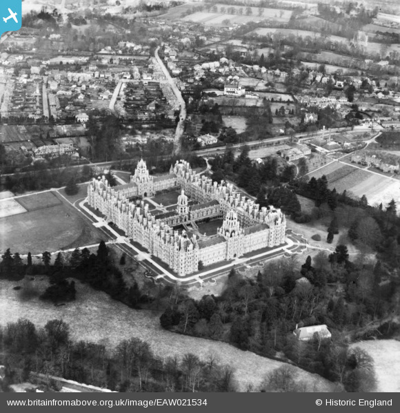
EAW021534 ENGLAND (1949). Royal Holloway College and environs, Englefield Green, 1949. This image has been produced from a print.
© Copyright OpenStreetMap contributors and licensed by the OpenStreetMap Foundation. 2026. Cartography is licensed as CC BY-SA.
Nearby Images (9)
EAW021534

 0°
0m
0°
0m
EAW021535
 216°
30m
216°
30m
EPW023508
 185°
47m
185°
47m
EPW023506
 169°
56m
169°
56m
EPW023507
 201°
56m
201°
56m
EAW021537
 177°
72m
177°
72m
EAW021536
 200°
77m
200°
77m
EPW008720
 207°
88m
207°
88m
EPW026268
 192°
107m
192°
107m
Details
| Title | [EAW021534] Royal Holloway College and environs, Englefield Green, 1949. This image has been produced from a print. |
| Reference | EAW021534 |
| Date | 19-March-1949 |
| Link | |
| Place name | ENGLEFIELD GREEN |
| Parish | |
| District | |
| Country | ENGLAND |
| Easting / Northing | 499758, 170547 |
| Longitude / Latitude | -0.56502251167927, 51.424649204183 |
| National Grid Reference | SU998705 |
Pins
Be the first to add a comment to this image!