
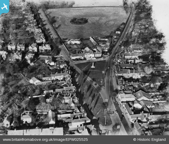
EPW025525 ENGLAND (1928). The war memorial, Stevenage, 1928. This image has been produced from a damaged print.
© Copyright OpenStreetMap contributors and licensed by the OpenStreetMap Foundation. 2026. Cartography is licensed as CC BY-SA.
Nearby Images (7)
EPW025525

EPW025521

EPW013408

EPW025522

EAW002088

EAW034138

EPW013409

Details
| Title | [EPW025525] The war memorial, Stevenage, 1928. This image has been produced from a damaged print. |
| Reference | EPW025525 |
| Date | 14-November-1928 |
| Link | |
| Place name | STEVENAGE |
| Parish | |
| District | |
| Country | ENGLAND |
| Easting / Northing | 523239, 225507 |
| Longitude / Latitude | -0.2080253199138, 51.914003948642 |
| National Grid Reference | TL232255 |
Pins

melgibbs |
Thursday 19th of March 2015 09:01:48 PM | |

Hugh Madgin |
Wednesday 12th of November 2014 12:28:43 PM |