
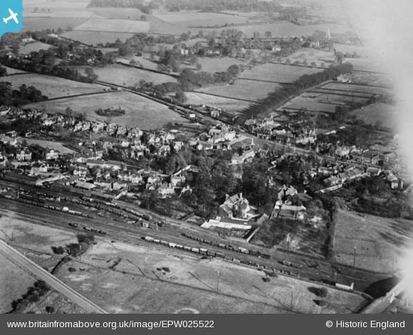
EPW025522 ENGLAND (1928). Old Town, Stevenage, 1928. This image has been produced from a copy-negative affected by flare.
© Copyright OpenStreetMap contributors and licensed by the OpenStreetMap Foundation. 2026. Cartography is licensed as CC BY-SA.
Nearby Images (6)
EPW025522

EPW025525

EPW025521

EPW013408

EAW002088

EAW034138

Details
| Title | [EPW025522] Old Town, Stevenage, 1928. This image has been produced from a copy-negative affected by flare. |
| Reference | EPW025522 |
| Date | 14-November-1928 |
| Link | |
| Place name | STEVENAGE |
| Parish | |
| District | |
| Country | ENGLAND |
| Easting / Northing | 523163, 225473 |
| Longitude / Latitude | -0.20914198573869, 51.913715189219 |
| National Grid Reference | TL232255 |
Pins

SueB |
Wednesday 10th of April 2024 08:32:46 PM | |
|
andy |
Tuesday 23rd of July 2019 09:29:40 AM | |
|
andy |
Tuesday 23rd of July 2019 09:28:33 AM | |
|
Howie |
Sunday 15th of February 2015 08:02:59 AM | |
|
Hugh Madgin |
Wednesday 12th of November 2014 12:32:40 PM |