
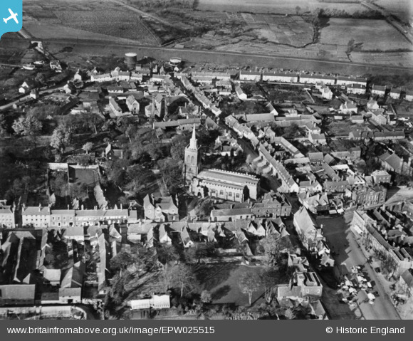
EPW025515 ENGLAND (1928). St Mary's Church, Baldock, 1928. This image has been produced from a copy-negative.
© Copyright OpenStreetMap contributors and licensed by the OpenStreetMap Foundation. 2025. Cartography is licensed as CC BY-SA.
Nearby Images (6)
EPW025515

EPW025516

EPW013415

EPW013414

EPW013412

EPW013413

Details
| Title | [EPW025515] St Mary's Church, Baldock, 1928. This image has been produced from a copy-negative. |
| Reference | EPW025515 |
| Date | 14-November-1928 |
| Link | |
| Place name | BALDOCK |
| Parish | |
| District | |
| Country | ENGLAND |
| Easting / Northing | 524371, 233948 |
| Longitude / Latitude | -0.18851890103642, 51.989614272164 |
| National Grid Reference | TL244339 |
Pins
 John Wass |
Wednesday 11th of January 2017 02:35:26 PM |