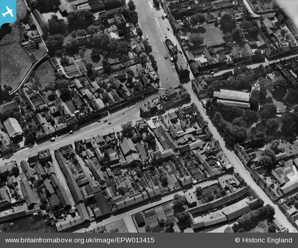
EPW013415 ENGLAND (1925). The junction of White Horse Street and the High Street, Baldock, 1925
© Copyright OpenStreetMap contributors and licensed by the OpenStreetMap Foundation. 2025. Cartography is licensed as CC BY-SA.
Nearby Images (6)
Details
| Title | [EPW013415] The junction of White Horse Street and the High Street, Baldock, 1925 |
| Reference | EPW013415 |
| Date | June-1925 |
| Link | |
| Place name | BALDOCK |
| Parish | |
| District | |
| Country | ENGLAND |
| Easting / Northing | 524476, 233951 |
| Longitude / Latitude | -0.18698929949883, 51.989617709084 |
| National Grid Reference | TL245340 |
Pins
Be the first to add a comment to this image!
User Comment Contributions
This image has been incorrectly reversed. |
 Qu1ckn1ck |
Friday 14th of April 2017 10:49:30 AM |


![[EPW013415] The junction of White Horse Street and the High Street, Baldock, 1925](http://britainfromabove.org.uk/sites/all/libraries/aerofilms-images/public/100x100/EPW/013/EPW013415.jpg)
![[EPW025516] The town, Baldock, 1928. This image has been produced from a copy-negative.](http://britainfromabove.org.uk/sites/all/libraries/aerofilms-images/public/100x100/EPW/025/EPW025516.jpg)
![[EPW013414] White Horse Street and environs, Baldock, 1925](http://britainfromabove.org.uk/sites/all/libraries/aerofilms-images/public/100x100/EPW/013/EPW013414.jpg)
![[EPW013413] The town centre, Baldock, 1925](http://britainfromabove.org.uk/sites/all/libraries/aerofilms-images/public/100x100/EPW/013/EPW013413.jpg)
![[EPW025515] St Mary's Church, Baldock, 1928. This image has been produced from a copy-negative.](http://britainfromabove.org.uk/sites/all/libraries/aerofilms-images/public/100x100/EPW/025/EPW025515.jpg)
![[EPW013412] The town centre, Baldock, 1925](http://britainfromabove.org.uk/sites/all/libraries/aerofilms-images/public/100x100/EPW/013/EPW013412.jpg)