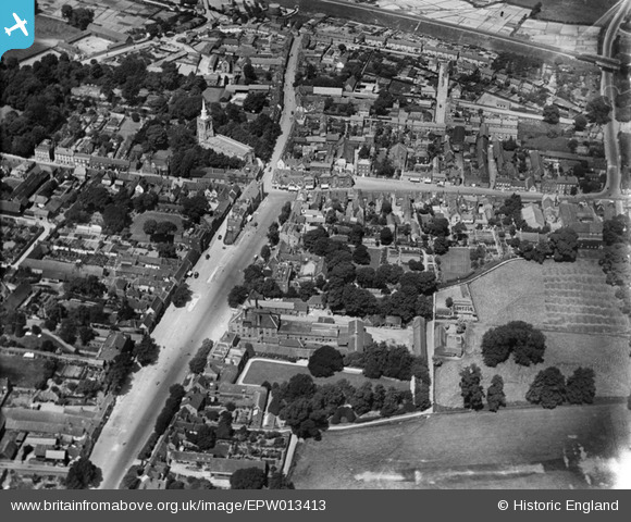
EPW013413 ENGLAND (1925). The town centre, Baldock, 1925
© Copyright OpenStreetMap contributors and licensed by the OpenStreetMap Foundation. 2025. Cartography is licensed as CC BY-SA.
Nearby Images (6)
Details
| Title | [EPW013413] The town centre, Baldock, 1925 |
| Reference | EPW013413 |
| Date | June-1925 |
| Link | |
| Place name | BALDOCK |
| Parish | |
| District | |
| Country | ENGLAND |
| Easting / Northing | 524540, 233880 |
| Longitude / Latitude | -0.18608342499663, 51.988965265884 |
| National Grid Reference | TL245339 |
Pins
 Howie |
Friday 3rd of April 2015 03:27:59 AM | |
 Howie |
Friday 3rd of April 2015 03:26:41 AM | |
 Hugh Madgin |
Wednesday 22nd of May 2013 09:00:26 PM | |
 Hugh Madgin |
Wednesday 22nd of May 2013 08:51:11 PM | |
 Hugh Madgin |
Wednesday 22nd of May 2013 08:30:42 PM |


![[EPW013413] The town centre, Baldock, 1925](http://britainfromabove.org.uk/sites/all/libraries/aerofilms-images/public/100x100/EPW/013/EPW013413.jpg)
![[EPW025516] The town, Baldock, 1928. This image has been produced from a copy-negative.](http://britainfromabove.org.uk/sites/all/libraries/aerofilms-images/public/100x100/EPW/025/EPW025516.jpg)
![[EPW013415] The junction of White Horse Street and the High Street, Baldock, 1925](http://britainfromabove.org.uk/sites/all/libraries/aerofilms-images/public/100x100/EPW/013/EPW013415.jpg)
![[EPW013412] The town centre, Baldock, 1925](http://britainfromabove.org.uk/sites/all/libraries/aerofilms-images/public/100x100/EPW/013/EPW013412.jpg)
![[EPW013414] White Horse Street and environs, Baldock, 1925](http://britainfromabove.org.uk/sites/all/libraries/aerofilms-images/public/100x100/EPW/013/EPW013414.jpg)
![[EPW025515] St Mary's Church, Baldock, 1928. This image has been produced from a copy-negative.](http://britainfromabove.org.uk/sites/all/libraries/aerofilms-images/public/100x100/EPW/025/EPW025515.jpg)