
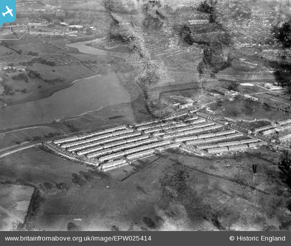
EPW025414 ENGLAND (1928). A new housing estate on the North Circular Road by the Brent Reservoir, Dollis Hill, 1928. This image has been produced from a damaged negative.
© Copyright OpenStreetMap contributors and licensed by the OpenStreetMap Foundation. 2026. Cartography is licensed as CC BY-SA.
Nearby Images (17)
EPW025414

EPW025396

EPW025410

EPW025411

EPW025417

EPW025398

EPW055816

EPW025415

EPW055819

EPW025397

EPW055817

EPW025416

EPW055814

EPW055818

EPW055813

EPW021257

EPW055815

Details
| Title | [EPW025414] A new housing estate on the North Circular Road by the Brent Reservoir, Dollis Hill, 1928. This image has been produced from a damaged negative. |
| Reference | EPW025414 |
| Date | 9-November-1928 |
| Link | |
| Place name | DOLLIS HILL |
| Parish | |
| District | |
| Country | ENGLAND |
| Easting / Northing | 521786, 186915 |
| Longitude / Latitude | -0.24265404349354, 51.567463693535 |
| National Grid Reference | TQ218869 |
Pins

Simon |
Tuesday 12th of April 2016 10:44:57 PM |